A Historical Overview
An Introduction to Scituate History
Taken from text by Wilmot M. Brown (1961)
In this text we propose to set forth not a complete history of the Town of Scituate. This is a very abbreviated account giving the fundamentals of such history, and which might be of interest to our newer citizens and to those who may at some time wish to become residents.
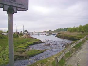
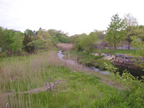 The name Scituate is derived from an Indian word which the early settlers understood as Satuit, which means "Cold Brook", and referred to the small stream flowing into the harbor; this they spelled in various ways as Sityate, Cituate, Seteat, etc., and it was not until about 1640 that the name came to be universally spelled in its present form. No one knows why the silent "c" was added, but around that time it was quite common to add this "c" to such words as site, situation, etc.
Scituate more than any other location along the shore of Cape Cod Bay presented to the explorer a distinctive front toward the sea which very soon after the settlement at Plymouth attracted venturesome colonists to our shores looking for fertile lands to cultivate and perhaps to find a suitable place to live and establish their homes. The sea front marked as it was by four water washed gravel cliffs suggested good planting lands in the interior, and it was on one of these cliffs that the first use of the land was made for this purpose, this was previous to 1628, we do not know for sure the exact year the first plantings were made here.
In some part of the years 1627 or 1628 a group from Plymouth augmented by new arrivals from the County of Kent in England came here and formed the first permanent settlement. They laid out their village a mile or so back from the coast behind one of the cliffs, established a public way or street, which they named Kent Street, which name it still bears, and allotted space on this street to the various householders forming the Company. They were of course under the jurisdiction of the General Court at Plymouth, and it was not until 1636 when the population had increased that permission was given to elect certain officers and to some extent carry on their own affairs, an act which we refer to as the incorporation of the Town, and its boundaries were established substantially as follows: on the east the sea, south the North River and is tributary the Indian head River to its head, westerly by a line to the centre of Accord Pond, and from thence to the sea by the line marking the boundary between the Plymouth and Massachusetts Bay Colonies. Other grants were later, viz. the so called Two Mile in Marshfield and the Hatherly Grant of three miles square on the westerly side of the above boundaries which is now contained in the Town of Rockland, then a part of Abington.
In establishing the bounds of Scituate the General Court at Plymouth took the somewhat strange action of reserving a section in the northerly part of the Town for the exclusive benefit of certain individuals, viz. Messrs. Hatherly, Beauchamp and Shirley. This grant included the entire part of the Town northerly from Satuit Brook and extending to the Conihasset marshes; as the bounds were not definite and some settlers had previously occupied parts of this land controversies arose which were not adjusted for several years. In the meantime Mr. Hatherly purchased the entire tract from the other grantees and in 1646 divided it into thirty shares, reserving one fourth of them for himself and sold the remaining for 180 pounds to a company which became known as the Conihasset Partners, which Company functioned as a Government, carrying on its own affairs, building its own roads, keeping its own records etc. in disregard of the fact that they were legally and technically a part of the Town of Scituate with no objections on the part of the Town, which was due probably to the fact that the proprietors of the Conihasset Grant were also men interested in the government of the Town itself The last meeting of the Partners was held in 1767, after which their affairs reverted to the town.
As time when on and the population in the westerly part of the Town increased the people there becoming desirous of self government a portion of the original grant was separated and incorporated as the town of Hanover, this was in 1717 and seems to have been accomplished without any serious opposition by the parent town, and in 1849 a further reduction in the territory of the town was made by the separation of another westerly section which became the town of South Scituate, which name was later changed to Norwell, in honor of a prominent citizen and benefactor of that town. The section referred to above as the Two Mile, really a part of Marshfield was cede back to that town in 1788, again without any serious opposition on the part of the people of Scituate. Thus the town became as it is now, containing about 10,000 acres and in possession of its greatest asset, the several miles of shore line and beaches, which was formerly considered a useless liability, but is now the most valuable property in town.
Scituate in common with other country towns was a slow growth in population during the first two centuries of its existence; the lack of good roads and the difficulties of transportation did not encourage people to settle here so the greatest increase was in or near large cities.
The coming of the railroad in 1871 helped to some extent, but it was not until the advent of the automobile and the building of better roads that any marked increase was noted. As late as 1900 the population hardly exceeded 2000, from then on the increase was rapid and in the last ten years a great increase in population has occurred so that the census of 1960 gives it as between eleven and twelve thousand.